Remote sensing and GIS are transforming global sanitation management by making invisible service gaps visible, measurable, and actionable at scale. In sanitation, remote sensing means collecting information about land, water, settlements, and infrastructure without touching them directly, usually through satellites, drones, or aircraft. GIS, or geographic information systems, is the framework used to store, map, analyze, and share that spatial data alongside census records, utility assets, health indicators, and field surveys. Together, these tools help governments, utilities, NGOs, and investors understand where toilets are missing, where fecal sludge flows, which treatment plants are overloaded, and which communities face the greatest exposure to contamination.
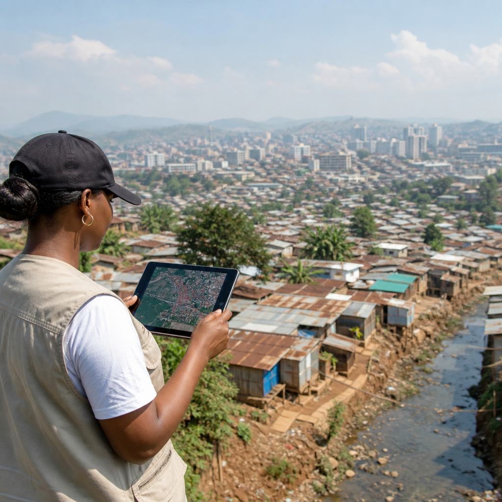
I have worked on sanitation planning projects where baseline maps were years out of date, informal settlements had no official street grid, and desludging routes existed only in drivers’ memories. In those settings, a satellite image often provided the first reliable picture of settlement growth, flood pathways, or proximity to drainage channels. Once those layers were brought into GIS and combined with household surveys, road networks, and treatment capacity data, sanitation planning became less reactive and far more strategic. That shift matters because sanitation is not only a public health service. It is also a land use issue, a climate resilience issue, a financing issue, and a governance issue.
Global opportunities in sanitation are increasingly tied to data quality. The world still faces major service deficits, especially in rapidly urbanizing regions of Sub-Saharan Africa and South Asia, where utilities and municipalities must extend services faster than traditional mapping methods can keep up. Poor sanitation contributes to diarrheal disease, groundwater pollution, school absence, unsafe work, and environmental degradation. At the same time, better sanitation creates economic value through lower health costs, increased productivity, improved tourism, nutrient recovery, energy generation from waste, and stronger urban land markets. Remote sensing and GIS support these opportunities by helping decision makers target investment, monitor progress, and reduce uncertainty.
This hub article explains how remote sensing and GIS strengthen global sanitation management across the full service chain: containment, emptying, transport, treatment, reuse, and safe disposal. It also shows how these tools connect sanitation to broader opportunities such as climate adaptation, inclusive urban development, blended finance, and digital public infrastructure. For readers exploring the wider Global Challenges and Opportunities topic, this page serves as a practical foundation. It answers a basic but essential question: how can spatial intelligence turn sanitation from a chronic service gap into a coordinated system that protects health and unlocks development?
Why spatial intelligence matters across the sanitation service chain
Sanitation failures are spatial by nature. A poorly sited pit latrine can contaminate a shallow aquifer; an undersized sewer can overflow into the nearest low point; an illegal discharge often appears first in a drainage canal or river reach downstream. GIS matters because it links these conditions to exact locations and allows analysts to model relationships among density, topography, flood risk, travel time, land tenure, and treatment capacity. A sanitation map is not just a picture. It is an operational decision tool.
Across the service chain, the first opportunity is service gap identification. High resolution imagery from providers such as Maxar, Planet, or public programs like Sentinel and Landsat can detect settlement expansion, roof density, road access, and open drains. Analysts combine those layers with demographic estimates, water point locations, and household survey data from DHS, MICS, or national censuses to identify neighborhoods likely to depend on on-site sanitation and areas where open defecation risk remains high. In several cities, I have seen utilities use this method to prioritize ward-level enumeration before designing fecal sludge management systems.
The second opportunity is asset management. GIS can maintain georeferenced records of public toilets, sewers, lift stations, transfer stations, treatment plants, and discharge points. Utilities using platforms such as ArcGIS, QGIS, GeoServer, KoboToolbox, and mWater can tie each asset to inspection histories, photos, maintenance logs, and performance indicators. That matters in low-capacity environments because institutional memory is fragile. When staff turn over, mapped assets preserve operational knowledge that would otherwise disappear.
The third opportunity is risk reduction. Remote sensing can reveal flood plains, wetness indices, impervious surface change, shoreline encroachment, and vegetation stress near polluted waterways. When those layers are overlaid with sanitation facilities, planners can identify pits at risk of inundation, neighborhoods where septic tanks cannot be safely sited, or treatment plants exposed to sea level rise. This enables a preventive approach. Instead of rebuilding after contamination events, authorities can adapt designs in advance.
Remote sensing applications: from settlement mapping to environmental surveillance
Remote sensing contributes different kinds of evidence depending on spatial resolution, revisit frequency, and sensor type. Optical satellite imagery is useful for mapping built-up areas, road access, drainage patterns, and land cover. Synthetic aperture radar, used by missions such as Sentinel-1, is especially valuable in cloudy regions because it can penetrate cloud cover and support flood mapping. Thermal imagery can identify temperature anomalies linked to wastewater discharge, while drone imagery helps with detailed corridor mapping, treatment plant surveys, and informal settlement enumeration.
One of the most practical uses is settlement classification. In sanitation planning, the difference between planned low-density housing, dense informal settlements, peri-urban expansion, and rural villages determines what technologies are feasible. Sewerage may make sense in dense cores with strong water supply and road access, while container-based sanitation, communal systems, simplified sewers, or scheduled desludging may fit other contexts better. Satellite-derived building footprints and density metrics help planners classify these areas faster than conventional surveys alone.
Environmental surveillance is another high-value use case. Remote sensing cannot directly measure every pollutant in fecal contamination, but it can track proxies and exposure conditions. Analysts can monitor algal blooms, sediment plumes, flood extent, seasonal standing water, and land use change around rivers and wetlands receiving wastewater. In coastal cities, this helps link sanitation underperformance to degraded beaches, fisheries pressure, and tourism losses. In agricultural regions, it supports decisions about safe wastewater reuse and buffer zone management.
Remote sensing also supports humanitarian sanitation. In refugee settlements, conflict-affected cities, and disaster zones, new infrastructure appears faster than official records can update. Rapid mapping from drones or commercial satellites can estimate population distribution, identify drainage bottlenecks, and locate areas suitable for emergency latrines or desludging access. During cholera response, these maps become operational tools for placing chlorination points, hygiene outreach teams, and temporary waste handling sites.
GIS for planning, targeting, and investment prioritization
GIS turns raw imagery into decisions by integrating layers that reflect demand, vulnerability, cost, and feasibility. A strong sanitation GIS usually includes administrative boundaries, parcels, road networks, elevation models, flood zones, population estimates, poverty indicators, groundwater depth, utility service areas, and existing sanitation assets. Once those layers are in place, planners can build suitability models. For example, a city can score land parcels for a fecal sludge treatment plant using distance from residences, haulage travel time, flood risk, environmental buffers, and connection to power and roads.
Investment targeting is where GIS creates immediate value. In many low-income cities, the budget cannot cover citywide upgrades at once. Spatial prioritization helps answer which neighborhoods should receive public toilets, where transfer stations would reduce hauling costs, or which peri-urban clusters could support decentralized wastewater treatment. Multi-criteria analysis in GIS makes tradeoffs explicit. Decision makers can weight health burden, service exclusion, gender and disability access, school density, and climate risk rather than relying on political intuition alone.
For hub-level readers exploring global opportunities in sanitation, this is the key point: better maps improve capital efficiency. They reduce the chance of building facilities in the wrong place, undersizing a plant, or ignoring inaccessible settlements that later become the highest-cost service gaps. Development banks and impact investors increasingly expect geospatial evidence in project preparation because it sharpens demand forecasts and strengthens monitoring frameworks.
| Sanitation decision | GIS layers used | Practical outcome |
|---|---|---|
| Locate fecal sludge treatment plant | Road network, haul distance, land use, flood risk, buffers, power access | Lower transport cost and fewer siting conflicts |
| Target public toilet investment | Population density, markets, schools, transit nodes, gender safety data | Higher usage and stronger social return |
| Prioritize desludging service zones | Septic tank density, truck access, income data, overflow complaints | More efficient scheduled emptying |
| Assess climate vulnerability | Elevation, flood extent, groundwater depth, shoreline change | More resilient containment and treatment design |
Monitoring service delivery, equity, and public health outcomes
Sanitation management does not end when infrastructure is built. GIS is equally important for monitoring whether services actually work. Municipal dashboards can track collection frequency, truck movements, treatment plant inflow, effluent compliance, complaint locations, and customer payment status. When linked to mobile data collection, each field visit becomes a mappable record. Over time, this creates an empirical view of where systems break down.
Equity analysis is one of the strongest global opportunities in sanitation because spatial data exposes who is being left behind. Many cities report average coverage numbers that hide severe inequalities within informal settlements, low-income peri-urban areas, or unrecognized communities. Mapping service quality by neighborhood, gender-sensitive facility access, disability access routes, or school sanitation conditions helps agencies target underserved populations more fairly. It also supports results-based financing, where disbursement depends on verified service delivery to priority groups.
Health integration adds another layer of value. When sanitation maps are compared with diarrheal disease reports, cholera alerts, child stunting hotspots, or environmental sampling results, officials can detect clusters that warrant intervention. This does not prove causation by itself, but it improves surveillance and prioritization. Public health teams, utilities, and planning departments rarely share data well; GIS gives them a common operating picture. In practice, that shared map often does more to improve coordination than another policy document.
Verification is essential. Satellite and administrative data should be ground-truthed through household surveys, utility records, and field audits. Informal settlements are dynamic, and algorithmic classification can misread roofing materials, vegetation cover, or drainage features. Good sanitation GIS is iterative: map, verify, update, and adjust decisions. That discipline builds trust in the data and improves long-term planning.
Global opportunities, implementation challenges, and the path forward
The global opportunities in sanitation supported by remote sensing and GIS are substantial. Cities can expand fecal sludge management faster, utilities can improve non-network service oversight, ministries can direct subsidies more accurately, and donors can compare investment scenarios using transparent evidence. Circular economy models also benefit. Mapping wastewater generation, organic waste sources, industrial demand, agricultural zones, and transport routes helps determine whether biosolids composting, biogas, black soldier fly treatment, or water reuse can work commercially. Spatial analysis is often what separates an interesting pilot from a viable business model.
There are, however, real constraints. Data governance is often weak, with overlapping mandates among ministries, utilities, and local governments. Licensing costs for commercial imagery may be high, although free data from Copernicus, Landsat, and OpenStreetMap lowers barriers. Technical capacity is uneven; sophisticated models fail when no one can maintain them. Privacy also matters. Mapping toilets, disease risk, or informal settlements can stigmatize communities if data is shared irresponsibly. Clear protocols for aggregation, access control, and community engagement are not optional.
The most effective implementations start simple. Build a core GIS with reliable basemaps, agreed asset definitions, and mobile field collection. Use open standards from the Open Geospatial Consortium where possible. Train utility and municipal staff to update layers themselves rather than depending entirely on consultants. Then add advanced analytics such as machine learning for building detection, route optimization for desludging trucks, or flood exposure modeling for climate resilience. The technology stack matters, but governance matters more. Institutions that routinely use spatial evidence make better sanitation decisions than institutions that own impressive software but no operating process.
Remote sensing and GIS give sanitation leaders a way to see the whole system, from household containment to watershed impact, and to act with greater precision. They improve targeting, resilience, accountability, and investment readiness across urban, peri-urban, rural, and humanitarian contexts. For anyone building a strategy around global opportunities in sanitation, this hub principle is clear: spatial intelligence turns fragmented interventions into managed services. Start with the map, connect it to operations, and use it to direct the next sanitation dollar where it will protect the most people and create the most durable value.
Frequently Asked Questions
What do remote sensing and GIS actually mean in the context of global sanitation management?
In global sanitation management, remote sensing refers to gathering information about physical conditions on the ground without direct contact, most commonly through satellites, drones, or aircraft. These tools can reveal patterns in land use, drainage, water bodies, settlement growth, flood-prone zones, road access, and even environmental changes that affect sanitation service delivery. GIS, or geographic information systems, is the platform that organizes this spatial information and connects it with other critical datasets such as population counts, utility networks, public health records, facility locations, and service coverage boundaries.
Together, remote sensing and GIS help sanitation planners move from assumptions to evidence-based decision-making. Instead of relying only on fragmented surveys or outdated maps, governments, utilities, NGOs, and development agencies can visualize where people live, where sanitation infrastructure exists, where it is missing, and which communities face the highest risks. This is especially valuable in rapidly growing urban settlements, informal neighborhoods, peri-urban areas, and rural regions where conventional infrastructure records may be incomplete or nonexistent.
In practical terms, these technologies make sanitation challenges visible, measurable, and actionable at scale. A planner can identify neighborhoods lacking sewer connections, map areas dependent on on-site sanitation, assess proximity to contaminated waterways, and prioritize interventions based on population density, terrain, and vulnerability. That combination of broad geographic coverage and analytical precision is why remote sensing and GIS are becoming central to modern sanitation planning worldwide.
How are remote sensing and GIS used to identify sanitation service gaps?
One of the biggest challenges in sanitation management is that service gaps are often poorly documented. Households without safe toilets, communities depending on unsafe pit latrines, areas with failing drainage, or neighborhoods underserved by fecal sludge collection may not appear clearly in traditional administrative records. Remote sensing and GIS help uncover these blind spots by combining imagery with mapped demographic, environmental, and infrastructure data.
For example, high-resolution satellite images can detect settlement expansion, building density, road accessibility, and land conditions that influence sanitation service delivery. GIS can then overlay these observations with census data, utility boundaries, known sewer lines, treatment plant locations, desludging routes, and health indicators. This allows decision-makers to compare where people live with where services actually reach. The result is a much clearer picture of underserved zones, including informal settlements, flood-exposed communities, and isolated rural clusters.
These tools also help distinguish between different types of sanitation need. Some areas may require sewer network expansion, while others may be better suited for decentralized systems or stronger fecal sludge management. In dense urban neighborhoods, GIS can show whether access roads are too narrow for desludging trucks. In low-lying areas, remote sensing can reveal recurring inundation that compromises toilets and containment systems. By turning scattered data into a layered map of risk and service access, remote sensing and GIS enable more accurate targeting of investments, operations, and policy interventions.
What kinds of sanitation problems can satellites, drones, and spatial analysis help monitor?
Remote sensing and GIS can support monitoring across a wide range of sanitation-related issues, even when infrastructure is difficult to inspect directly. Satellites can track land cover change, settlement growth, standing water, surface moisture, flood patterns, erosion, and proximity between human settlements and water resources. These indicators matter because sanitation performance is closely tied to geography, hydrology, climate, and urban development. When these conditions change, sanitation risks often change with them.
Drones and aircraft can provide even more detailed imagery for local assessments. They are useful for mapping drainage channels, identifying illegal discharge points, documenting solid waste accumulation that affects wastewater flow, and assessing the condition of treatment ponds, outfalls, and hard-to-access facilities. In places where field access is difficult due to distance, safety concerns, or seasonal flooding, aerial data collection can provide an efficient alternative.
GIS adds the analytical layer that turns images into operational insight. Spatial analysis can identify populations living near polluted waterways, estimate which households are outside formal service zones, map repeated service failures, and locate infrastructure exposed to climate hazards. It can also support public health analysis by comparing sanitation access with disease outbreaks or environmental contamination patterns. While remote sensing cannot replace every on-the-ground inspection, it is extremely effective for broad monitoring, early detection of risk, and prioritizing where field teams should focus limited resources.
Why are remote sensing and GIS especially important for sanitation planning in low-resource and rapidly growing areas?
In many low-resource settings, sanitation planning is constrained by limited budgets, incomplete records, outdated maps, and fast-changing settlement patterns. Informal urban expansion can outpace official data collection, leaving authorities without an accurate understanding of where people live or what services they use. Remote sensing and GIS are especially valuable in these environments because they provide scalable, repeatable ways to update spatial information and guide decisions with better evidence.
Instead of waiting years for new baseline surveys, planners can use recent imagery to identify newly built neighborhoods, densifying settlements, road connections, drainage corridors, and land constraints that shape sanitation options. GIS then makes it possible to integrate these observations with existing administrative datasets, even if those datasets are incomplete. This helps agencies prioritize interventions where need is highest, rather than distributing resources based only on political boundaries or outdated assumptions.
These tools also improve cost-effectiveness. When budgets are limited, poor targeting can waste valuable funds on projects that do not reach the most vulnerable communities. Spatial analysis helps identify where investments will have the greatest impact, whether that means expanding sewer coverage, improving fecal sludge collection logistics, protecting sanitation facilities from floods, or locating treatment infrastructure more strategically. In rapidly growing areas, remote sensing and GIS support a more adaptive planning model—one that responds to real settlement dynamics, environmental risks, and service inequities rather than relying on static plans that quickly become obsolete.
Can remote sensing and GIS improve sanitation outcomes beyond mapping and planning?
Yes. While mapping and planning are major benefits, the value of remote sensing and GIS extends into implementation, monitoring, maintenance, and accountability. Once sanitation assets and service areas are mapped, utilities and municipalities can use GIS to optimize collection routes, track maintenance needs, monitor facility performance, and coordinate field operations more efficiently. This is particularly useful for fecal sludge management, where routing, access, disposal, and treatment logistics can be complex and expensive.
These technologies also support stronger monitoring and evaluation. By comparing satellite or drone imagery over time, agencies can assess whether infrastructure is being built where planned, whether drainage or flood conditions are improving, and whether environmental pressures around sanitation sites are increasing. GIS dashboards can help decision-makers track progress against coverage targets, identify persistent service inequities, and communicate results more transparently to funders, regulators, and the public.
Perhaps most importantly, remote sensing and GIS strengthen accountability by making sanitation conditions easier to document and share. When service gaps are visible on a map, they are harder to ignore. Spatial evidence can support better coordination across health, water, urban planning, and environmental agencies, ensuring sanitation is treated as part of a broader system rather than an isolated sector. In that sense, these technologies do more than generate maps—they help create a more responsive, data-informed, and equitable approach to global sanitation management.