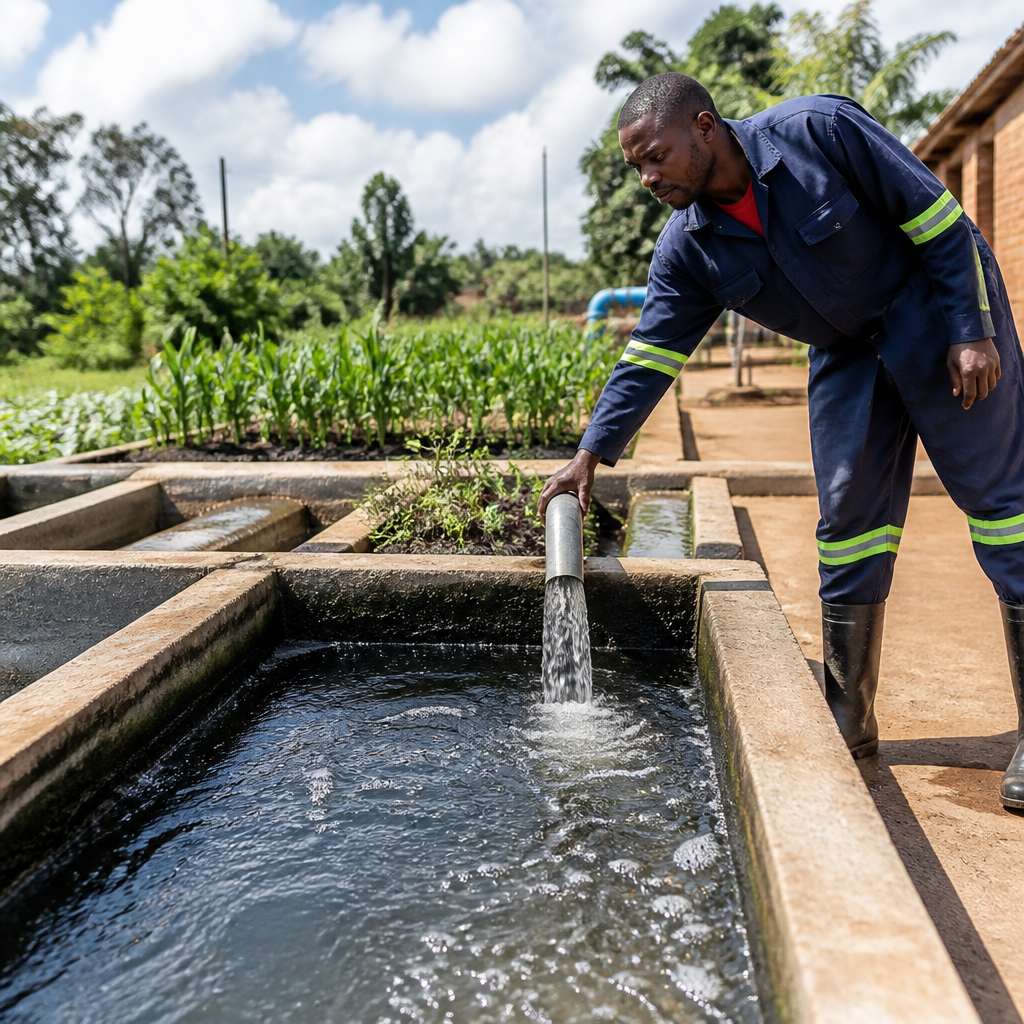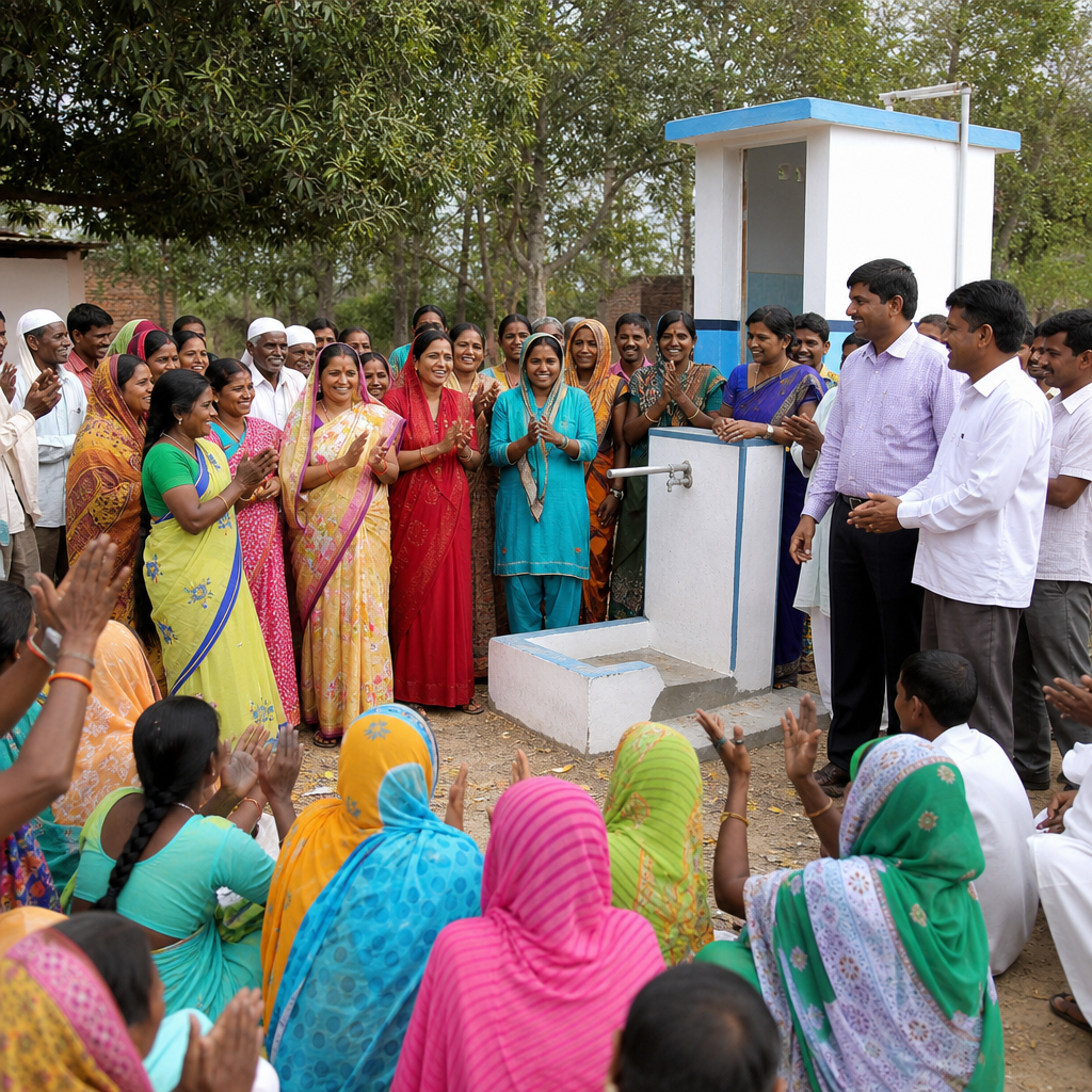

Utilizing Geographical Information Systems (GIS) in EcoSan Planning is increasingly recognized for its ability to streamline and enhance the decision-making process involved in ecological sanitation (EcoSan) projects. EcoSan is an innovative approach to sanitation focused on recycling nutrients and water in waste to improve environmental health and sustainability. GIS, a technology that allows for the representation and analysis of spatial data, provides valuable insights and data analysis capabilities that can foster more effective EcoSan initiatives. This article explores the depth, breadth, and critical role of GIS in EcoSan planning, particularly its impact on visualizing spatial data, understanding geographic relationships, and optimizing resources. The integration of GIS technology into EcoSan strategies offers transformative possibilities in terms of planning, implementation, and monitoring. This introduction underscores the importance of GIS in transforming traditional sanitation practices to meet the demands of growing populations and environmental sustainability.
The Role of GIS in EcoSan Planning
GIS serves as a powerful tool in EcoSan planning by providing the means to store, manipulate, analyze, and visualize geographical data. The fundamental aspect of EcoSan projects is the understanding and management of spatial information, and GIS excels by providing a robust framework for handling such complex data. GIS enables planners to visualize various environmental parameters such as topography, soil characteristics, water bodies, and existing infrastructure. These data sets form the foundation for site selection, design processes, and operational strategies tailored to specific geographic contexts.
In EcoSan planning, GIS assists in creating detailed maps that display crucial geographic and socio-demographic information. These visual tools help identify locations for sanitation facilities by analyzing features such as population density, proximity to water sources, and access to roads. By overlaying multiple datasets, GIS allows planners to see the relationships and dependencies between various geographical elements, enabling informed decision-making. For instance, decision-makers can identify high-risk flood zones where traditional sanitation might be ineffective and instead opt for flood-resistant EcoSan options.
Moreover, GIS plays a pivotal role in resource allocation by optimizing routes for waste collection and transport. Spatial data can guide efficient operational routes that minimize fuel consumption and emissions, aligning the logistical aspects of EcoSan systems with environmental objectives. This optimization process not only enhances operational efficiency but also ensures that EcoSan initiatives remain environmentally sustainable. In specific contexts, GIS analysis might determine that decentralized systems are more appropriate due to geographical constraints, thereby guiding customizable EcoSan solutions.
Another crucial dimension of GIS in EcoSan is its capacity to incorporate community data and engagement. Community involvement is indispensable in the success of EcoSan projects, and GIS can map socio-economic patterns and preferences, ensuring that sanitation solutions are culturally suitable and readily accepted by local populations. By including community input within spatial data frameworks, planners can produce EcoSan models that reflect both the physical and social landscapes of communities.
Applications of GIS in Site Selection
Site selection is one of the most critical steps in EcoSan planning, significantly influencing the effectiveness and sustainability of the system. GIS applications provide the analytical power to evaluate multiple criteria simultaneously thereby facilitating well-informed site selection decisions. With GIS technology, planners can apply Multi-Criteria Decision Analysis (MCDA) using various layers of spatial information such as land use patterns, soil permeability, and local climate data. This layered approach allows eco-planners to proactively identify sites that optimize environmental and socio-economic benefits while minimizing potential negative impacts.
In agricultural regions, GIS can evaluate soil nutrient content and overlay this data with land parcels’ proximity to waste generation sites. Such an analysis can guide the placement of EcoSan systems to areas where the recycling of nutrients can most benefit agricultural production. Similarly, in urban settings, GIS can assess population density, waste generation projections, and infrastructure distribution, ensuring strategic placement of EcoSan facilities to manage waste efficiently and reduce environmental burdens. GIS-driven site selection processes contribute to enhanced environmental stewardship while promoting health benefits and resource recovery.
Designing EcoSan Systems with GIS
The design phase of EcoSan planning involves the synthesis of spatial and technical data to create effective sanitation solutions. GIS facilitates this by providing a platform for visualizing and testing potential designs using real-world constraints and variables. It allows for dynamic simulations and models that account for changes in population growth, urbanization, and environmental conditions over time.
By analyzing spatial-temporal data, GIS helps planners anticipate future patterns of development and resource use, which is pivotal for designing scalable and adaptable EcoSan systems. For instance, GIS can simulate water flow in topographical models to design EcoSan facilities that capitalize on gravity for waste transportation or water management systems that harness natural water paths. Such insights ensure that EcoSan designs are efficient, require minimal energy inputs, and are technically viable given the landscape’s unique features.
Additionally, GIS enhances the design process by facilitating the inclusion of emergency planning scenarios. Planners can map potential disaster zones or areas prone to environmental risks, planning contingencies that integrate seamlessly with existing EcoSan infrastructure. This proactive design approach fosters resilience within EcoSan systems, ensuring continuous sanitation services even in adverse conditions.
Implementation and Monitoring
The implementation and monitoring stages of EcoSan projects benefit significantly from GIS technologies. GIS allows for continuous monitoring of EcoSan systems through visualization and analysis of performance data. Integrating GIS with remote sensing and IoT technologies can provide real-time data on system performance, enabling timely interventions when needed.
During the implementation phase, GIS enhances project management by tracking logistical deployments and construction activities. Planners can visualize the spatial distribution of resources and labor, coordinate efficient deployment of field teams, and monitor progress against established plans. This oversight lays the foundation for effective project execution, adherence to timelines, and optimal allocation of resources.
In the monitoring phase, GIS serves as an indispensable tool for mapping and analyzing patterns in data collected from EcoSan systems. This data allows practitioners to assess system efficiency, document performance metrics, and identify areas for improvement. Historical data stored within the GIS framework can uncover trends in usage and sustainability, ensuring continuous learning and adaptation within EcoSan strategies.
Furthermore, GIS supports environmental monitoring by analyzing pollutant levels and environmental health indicators. GIS-generated maps can reveal trends in surface water quality, soil health, and vegetation changes, enabling early detection of threats and the implementation of corrective measures. Such monitoring ensures that EcoSan systems fulfill their promise of improving environmental quality while providing reliable sanitation services.
Integrating GIS and Stakeholder Engagement
Stakeholder engagement is essential in all phases of EcoSan planning, and GIS plays a vital role in facilitating participation and collaboration. Community GIS mapping initiatives empower local residents to contribute knowledge and preferences, leading to designs that are culturally appropriate and socially accepted. Such initiatives foster transparency and accountability, enhancing stakeholder trust and support for EcoSan projects.
Participatory GIS platforms allow stakeholders to access, query, and interact with geographic data, fostering an understanding of spatial dynamics that influence EcoSan decisions. This collective engagement creates opportunities for co-learning and co-management, ensuring that diverse perspectives inform EcoSan solutions. The result is a collaborative, inclusive planning process that leverages local knowledge alongside technical insights to achieve community-driven sanitation improvements.
Moreover, GIS can communicate EcoSan outcomes and benefits to stakeholders through compelling visualizations and reports. This visual communication helps convey complex data clearly and effectively, facilitating understanding and stakeholder agreement on project objectives. Communication facilitated by GIS builds consensus and increases the likelihood of successful project implementation and long-term sustainability.
Conclusion
The integration of Geographical Information Systems (GIS) into EcoSan planning represents a significant advancement in the pursuit of sustainable sanitation solutions. GIS provides the frameworks necessary for interpreting spatial data, optimizing resource allocation, and fostering stakeholder engagement. These capabilities underpin EcoSan systems’ ability to deliver environmentally sound sanitation services that contribute to environmental, social, and economic sustainability.
The future of EcoSan is inextricably linked to the continuous evolution of GIS technologies. As GIS advancements continue, there will be even greater opportunities to integrate data across geographies, address emerging challenges, and develop systems that are robust, adaptable, and community-centered. Planners and stakeholders alike stand to benefit from embracing GIS in sanitation strategies, recognizing its potential to transform EcoSan initiatives through innovative, data-driven approaches.
Ultimately, using GIS in EcoSan underscores the imperative of technology-driven sanitation solutions in addressing the complex challenges posed by urbanization, resource scarcity, and environmental degradation. By leveraging GIS, EcoSan planners can create impactful, resilient, and sustainable sanitation systems poised to meet present and future needs while respecting ecological boundaries.
Frequently Asked Questions
1. What is the role of Geographical Information Systems (GIS) in EcoSan Planning?
Geographical Information Systems (GIS) play a pivotal role in EcoSan Planning by providing a robust platform for the collection, visualization, and analysis of spatial data related to ecological sanitation projects. Through GIS, planners can precisely map out geographical variables such as topography, land use, water sources, and population density, which are crucial for determining the most effective locations for EcoSan facilities. This data-driven approach enhances decision-making by enabling planners to assess the environmental and logistical aspects of potential sites, ensuring that the EcoSan systems are not only environmentally sustainable but also economically viable and accessible to the target populations.
2. How does GIS improve decision-making in EcoSan projects?
GIS improves decision-making in EcoSan projects by offering a comprehensive view of the environmental and sociodemographic landscape. The technology facilitates scenario modeling, which allows planners to simulate various outcomes based on different site selections or system designs. This foresight is essential for identifying potential risks and benefits, such as flood risk areas or communities most in need of sanitation improvement. Additionally, GIS supports stakeholder engagement by providing clear visualizations that can be easily interpreted by non-experts, thereby fostering community involvement and buy-in. By leveraging GIS, EcoSan planners can make more informed, data-backed choices that promote the long-term sustainability of sanitation solutions.
3. Can GIS help identify suitable locations for EcoSan systems?
Absolutely, GIS is instrumental in identifying suitable locations for EcoSan systems. By analyzing spatial data, GIS can highlight areas that meet specific criteria for successful EcoSan implementation. These criteria might include proximity to water sources, soil types conducive to nutrient recycling, and land use patterns that support easy access and minimal environmental disruption. Furthermore, GIS can integrate other data layers, such as existing infrastructure and social indices, to create a holistic picture of how an EcoSan system will fit into the local context. This ensures that chosen sites support the operational efficiency of the system, as well as community acceptance and usage.
4. What are some challenges associated with using GIS in EcoSan planning?
While GIS offers significant advantages in EcoSan planning, there are challenges to its adoption and implementation. One primary concern is the availability and resolution of relevant spatial data. In many regions, up-to-date and accurate data might be lacking, which can undermine the effectiveness of GIS analyses. Additionally, the technical expertise required to operate GIS software and interpret its outputs is a barrier for some organizations, potentially limiting their ability to fully leverage the technology. Moreover, the cost of acquiring high-quality data and GIS software can be prohibitive for smaller projects or organizations with limited budgets. Overcoming these challenges requires investment in capacity building and a strategic approach to data collection and management.
5. How does GIS contribute to the sustainability of EcoSan systems?
GIS makes a substantial contribution to the sustainability of EcoSan systems by enabling planners to adopt an integrated, systems-based approach to sanitation challenges. By utilizing GIS, designers can optimize system placement and design, ensuring that ecological and human health objectives are met effectively. The ability to map nutrient flows, model water cycles, and assess environmental impacts helps planners to design systems that recycle waste efficiently, reduce environmental footprint, and enhance local biodiversity. Furthermore, GIS can facilitate monitoring and evaluation by providing tools for tracking changes over time in system performance and environmental conditions, ensuring that EcoSan solutions not only address immediate sanitation needs but also support long-term ecological resilience.